
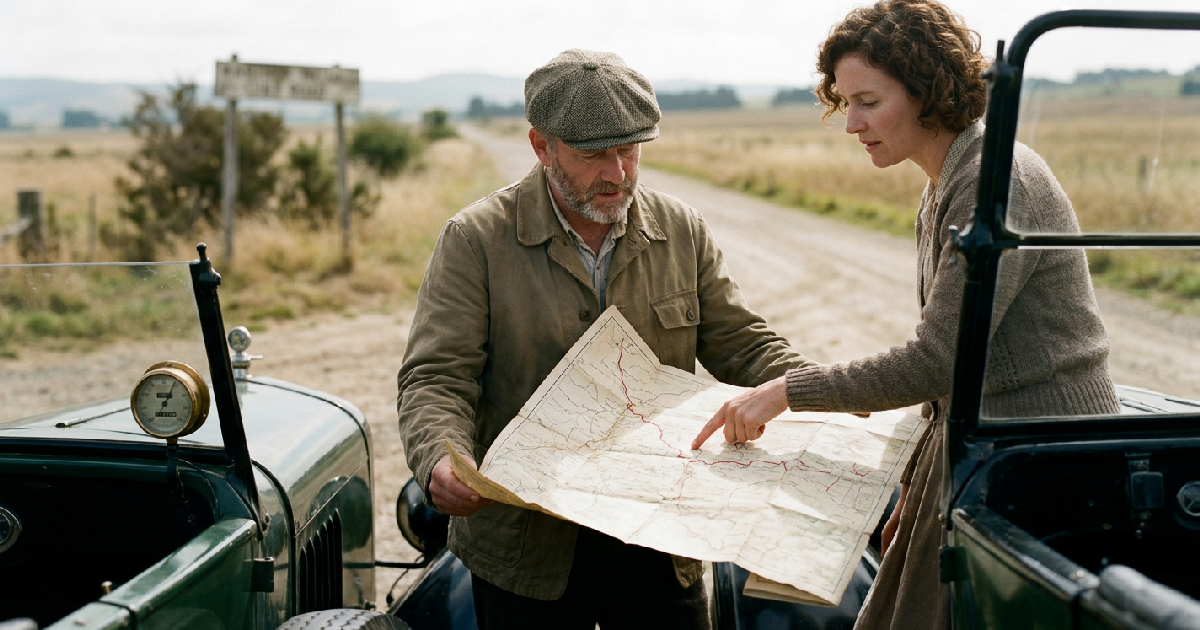

Long before satellite pings guided commuters through morning traffic, the American road trip was a high-stakes exercises in manual navigation. Before widespread GPS adoption, drivers relied on a complex mix of paper maps, passenger-led directional recording, and early mechanical devices like the Jones Live Map. From the first cross-town journeys in 1915 to the lifting of “selective availability” restrictions by the United States Space Command on May 2, 2000, driving required a specific set of spatial skills that have largely vanished in the digital age.
The transition from a two-million-car nation in 1915 to a society dependent on real-time signals reflects a profound shift in how humans interact with their environment. Early mapmaking was a grueling, manual labor that struggled to keep pace with rapid infrastructure growth. Because roads often changed names at county lines and signage was practically non-existent, the first generation of drivers focused more on landmarks than street names. This forced a certain degree of market resistance toward venturing onto unknown routes without a seasoned guide.
Drivers frequently stopped at local establishments to ask for help, receiving directions based on physical markers like bridges or prominent cafés. This fostered a communal “cardinal rule” among motorists: “pass it on.” If you knew the way, you shared it with the next person heading in that direction. This created a verbal network of navigation long before the advent of data-sharing apps. Just as modern on-chain signals allow analysts to track movements in real-time today, these verbal cues were the live data of their era.
Mechanical innovation and distance based route guides
The first significant challenge to verbal directions came in 1901 with the publication of the Automobile Blue Book. Originally targeted at wealthy travelers, it provided exhaustive descriptions of road conditions and intersections. By 1911, publications like Scientific American noted that “chief reliance” for drivers had officially shifted toward these printed route books and folded paper maps. Developing these guides required significant resources, including a vehicle with a high-precision odometer and a two-person team.
Creation of a guide necessitated one person to handle the vehicle while a passenger recorded every landmark and mileage point. Andrew McNally II, son of a Rand McNally & Co. founder, famously created the Rand McNally Chicago to Milwaukee Photo-Auto Guide of 1909 during his honeymoon. Working with his new bride, he documented more than 100 miles of turns. These were later supplemented with photo inserts of intersections to provide visual confirmation for lost travelers.
Technological experimentation flourished between 1910 and 1920, resulting in dozens of patented navigation gadgets. The Jones Live Map, introduced by the Jones Speedometer Company in 1909, was a modified odometer that used paper discs for turn-by-turn directions. Unlike a simple speedometer, the device attached to car gears to track miles driven. As the vehicle moved, the map rotated based on distance, providing a continuous depiction of the current location. Drivers had to swap discs every 100 miles.
The era of the wrist mounted scroll and atlases
As the middle class adopted automobiles, portable convenience became a priority for early 20th-century inventors. The 1920s saw the debut of the “Wrist Map,” a device worn like a watch that featured a small, scrollable paper map. Users turned knobs to advance the directions manually as they drove. However, these maps were strictly unidirectional. If a driver missed a turn, the device offered no way to recalculate the route.
Simultaneously, the Baldwin Auto Guide offered a scrolled map that could be attached directly to the steering wheel. This device even included a battery-operated light for night reading, addressing the persistent difficulty of reading tiny lines in low-visibility conditions. Despite these inventions, most families eventually settled on the foldable paper atlas as their primary tool. These large books containing maps for every state often barely fit in a standard glove box.
Using these paper tools meant accepting they did not update themselves. New roads or highway name changes were not reflected, which frequently led to drivers becoming stranded. Gas stations became essential hubs, not just for fuel, but for free state maps with city inserts. This era of driving was objectively slower and prone to error, but it tethered the driver to the geography in a way digital tools do not. It demanded knowledge of cardinal directions—north, south, east, and west.
From Navstar GPS to the smartphone revolution
The Department of Defense began developing the Navstar GPS project in the 1970s primarily for military applications. While it became available for civilian use in the 1990s, the government intentionally degraded the signal for non-military users. This policy, known as “selective availability,” limited the accuracy of the technology for the general public for a decade. Just as some fear fraudulent recovery schemes in modern finance, early users had to be wary of the reliability of degraded signals.
Everything changed on May 2, 2000, when the U.S. government disabled selective availability. This decision suddenly provided civilians with pinpoint accuracy that rendered most paper guides and mechanical distance trackers obsolete. Early standalone devices from Garmin and TomTom featured chunky screens stuck on dashboards. These pioneers eventualy gave way to smartphone integration, which added layers of live traffic data and points of interest.
While GPS has made travel safer and more efficient, the transition marked the end of a specific human skill set. Navigation was once a “real skill” requiring an active understanding of one’s surroundings. Today’s digital maps are the high-tech descendants of the Automobile Blue Book, still relying on the same principles of mileage and waypoints. The medium has changed from rotating paper discs to satellite pings, but the goal remains finding the path forward.